
Autumn 2004
| Intro | |||
| Photos | |||
| Olympiads | |||
| New Zealand | |||
| Spring 2003 | |||
| Wellington | |||
| Summer 03/04 | |||
| Autumn 2004 | |||
| Winter 2004 | |||
| Summer 2006 | |||
| Spring 2006 | |||
| Burning Seed 2010 | |||
| Space Holiday 2014 | |||
| Wettbewerbe | |||
| Kontakt | |||
Autumn 2004 started with a weekend trip to the north island - I flew into Auckland, drove down to Tongariro and all the way back just to do the Tongariro Crossing, a six-hour hike in Tongariro National Park! Pretty crazy and expensive aye - I don't know what I was thinking ;-) But the landscape was certainly impressive, and here come the pictures. A couple weeks later I went down south to Dunedin, a nice student town situated on the east coast, not too far from Moeraki with the famous Moeraki Boulders. The first of May brought another highlight, namely the P party held by my flat. On the third of May, I flew up to Palmerston North for a get together with the other people funded by the Allan Wilson Centre for Molecular Ecology and Evolution. From the 15th of May, a german friend (Karsten) and me spent three days tramping and sea kayaking the Abel Tasman Coastal Track, one of the tracks designated a "great walk" by New Zealand's department of conversation (DOC).
Some of the photos on this page are panoramic and thus extra-wide, so don't forget to scroll or view them in a resolution that fits your screen (if your browser supports that). You might want to press <F11> to use your full screen for viewing.
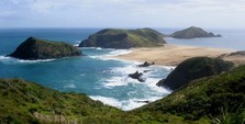
Cape Maria van Diemen (near Cape Reinga, on NZ's northern shore), where I did not go in February due to the bad weather. Therefore, this photo is courtesy of Karsten Sperling.
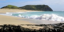
Cape Maria van Diemen again, photo courtesy of Karsten Sperling
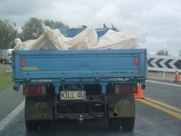
"K1LL 4U": an open carcass transport on our way from Auckland to Tongariro National Park.
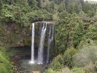
Omaru Falls - photo courtesy of Dominik Schultes (I had left my camera in the car)
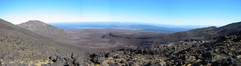
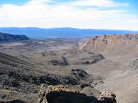
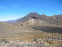
Nice panoramic view after the first ascent on the Tongariro Crossing
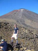
Me in front of Mt Ngauruhoe (AKA Mt Doom); the path leading up might be where Frodo climbed, but where is the entrance that leads to the fiery chasm with all the lava? Update: No, I am not growing breasts. It's just the picture and that tight polypro shirt.
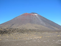
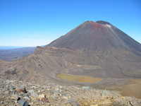
Mt Doom in all its glory. Where are those nasty hobbitses?
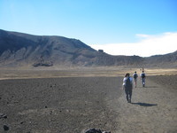
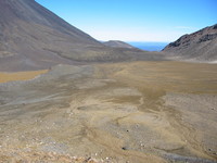
South Crater
View north (?)
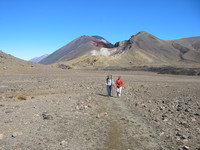
Mt Doom from somewhat further away
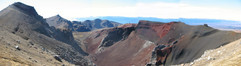
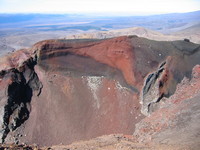
Red Crater panorama - I think the ridge on the left constitutes the highest point of the track
different view on Red Crater
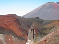
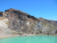
Red Crater again, with Mt Doom towering in the background
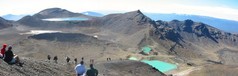
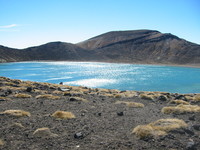
Panorama including the most famous part of the Tongariro Crossing: Blue Lake and the three Emerald Lakes with their distinct colour due to high mineral content; and hiker processions of course.
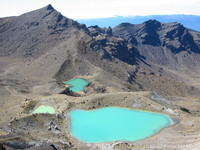
Emerald Lakes by themselves
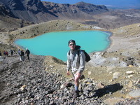
Me in front of the biggest Emerald Lake (I love this sexy outdoor clothing!)
view back up where we came from, the rim of Red Crater
Red Crater from further away
Red Crater even further away, taken from the shore of the Blue Lake
Same spot, but opposite direction: Blue Lake
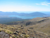
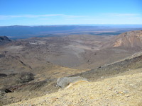
view north-west onto Lake Rotoaira and (huge, in the background) Lake Taupo
hot springs on our way down
Karsten at Lake Taupo
further to the right
Super Loo: Finally, technology has caught up with the most crucial aspects of our everyday life!
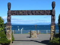
Lake Taupo, seen through an archway with Maori style ornaments
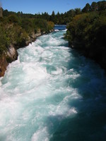
slightly upstream of Huka Falls
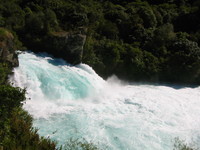
Huka Falls - apparently the most popular among the plethora of waterfalls on New Zealand's north island
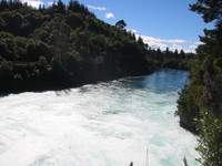
downstream of the falls
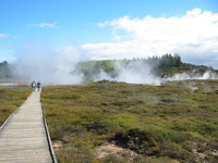
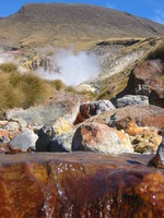
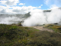
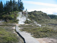
The "Craters of the Moon", near Lake Taupo. They are part of Wairakei, New Zealand's largest geothermal field. Its visible activity increased a lot when the Geothermal Power Station opened in 1958, draining water from geothermally heated underground supplies and thus increasing the heat of the remaining water.
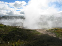
steaming vents
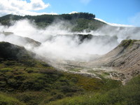
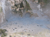
Hot mud pool (the bubbling mud was only visible during the sparse windy moments, and otherwise obfuscated by vapour)
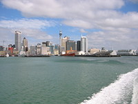
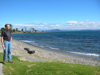
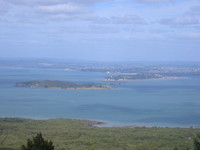
Auckland's skyline, on my boat trip to Rangitoto Island (a volcanic island a couple hundred meters from Auckland's shore that came into existance just a mere 600 years ago).
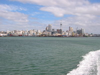
skyline from further away
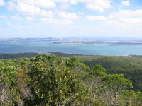
Auckland viewn from Rangitoto Island's summit
panoramic view from the summit
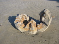
Moeraki Boulders on my way to Dunedin; this particular specimen isn't in the best spheroid shape any more though.
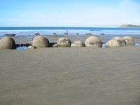
Some of the most perfectly spheroid and beautiful of the Moeraki Boulders (these are the ones that you get to see on the postcards!).
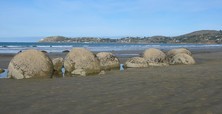
yup, these are the same ones
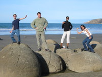
Posing on the Moeraki Boulders; from left to right: Tobias, Nicolas, Nafi, Naila. The McDonalds cup subtly compromises the picture's inherent coolness, though.
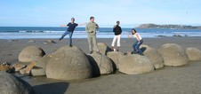
Another pose, for coolness' sake
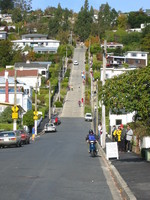
World's steepest street: Baldwin St. in Dunedin
pretty horizontal aye!
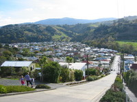
view from the top
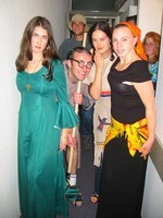
At our P party on 1 May, from left to right: Erin the plantagenet, Nicolas the Pizza (back), Daniel the pervert (front), Elizabeth as Pocahontas, Kirsten the psychic, Charlene the pacific painter.

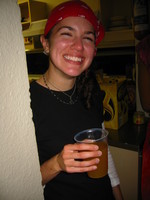
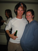
Mun the prostitute
Leslie the pirate

Paul the Paul, Nafi the pop star and Dana the prefect
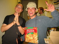
? the priest and Nicolas the pizza

Nafi the pop star and Nicolas the pizza
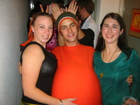
Kirsten the psychic, Tobias the pumpkin and Erin the plantagenet. Mysteriously, everybody felt constantly tempted to punch and/or rub my tender orange belly.
? the pot-head and Angelika, pregnant.
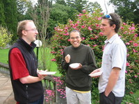
Some of my fellow researchers at the Allan Wilson Centre get together, at Massey University in Palmerston North, on 03/05/2004.

Mihaela Baroni, a very friendly romanian Mathematician from Christchurch.
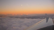
Sunset from the plane (why does the moon appear so small on photos?)
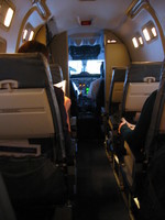
Approach to windy Wellington - it was quite exciting to see (through the open cockpit door) the plane alternately heading 30° either side of the runway orientation, due to the wind.
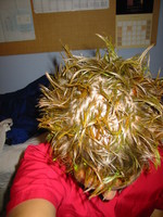
My fiery hair style for "Fuego III", the latin dance party of the year.
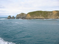
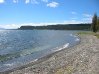
East end of the Marlborough sounds, on my way from Wellington to Picton by Ferry (14/05/2004).
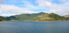
The Marlborough Sounds
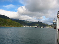
Picton
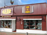
Barn's is an apparently stylish american pub in Picton. Unfortunately, its opening hours clashed with our travel plans.
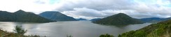
panoramic view from Picton over the Marlborough sounds
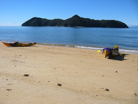
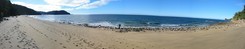
Sea Kayaking the Abel Tasman national park - both the scenery and the weather were superb; sorry for the artifacts that were a result of the stitching process and imperfectly aligned individual photos
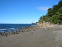
Non-panoramic section, but still beautiful and without stitching artifacts
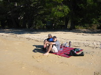
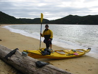
Our guide and Karsten, after Lunch
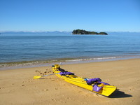
Our Kayak

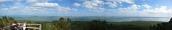
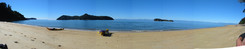
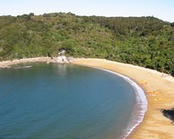
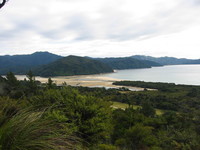
approx. 380° view of the estuary
Te Pukatea Bay
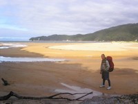
At Bark Bay; I look stupid and I am tired and wet, but at least we made it to the shore!
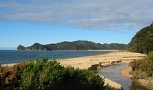
Me in the Awaroa Bay estuary, during low tide.
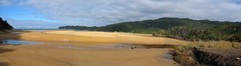
Awaroa Bay estuary from slightly further away
View back onto the Awaroa Bay estuary
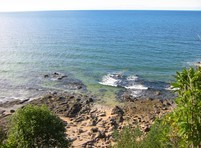
nice rocks and nice water
Waiharakeke (?)
Goat bay?
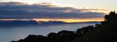
Beautiful sunset prelude near Separation Point, on our way to Whariwharangi Bay (we reached the hut precisely at sunset)
View north onto Separation Point
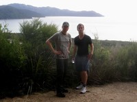
Karsten and me, on our way back from Whariwharangi Bay over Gibbs Hill
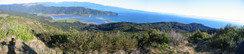
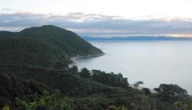
Beautiful panorama from Gibbs Hill
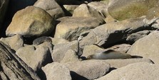
Seals on Tonga Island
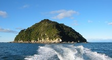
Tonga Island
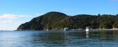
The Anchorage in Torrent Bay, with a swimming restaurant (photo taken on our way back by water taxi)
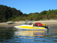
A different company's water taxi, collecting some kayaks and passengers
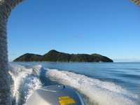
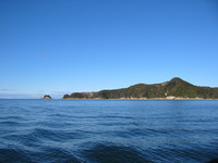
Adele Island
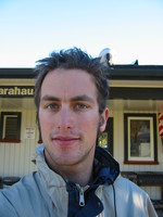
Me looking weird after three days without a shower or shave.
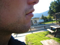
Natural hair growth
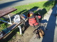
my pack
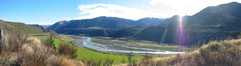
Near Lewis Pass, on our way back to Christchurch
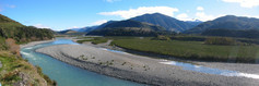
nearby
| Last change: 2024-02-17 22:30:56 GMT+0100 |