
New Zealand, Summer 2006
| Intro | |||
| Photos | |||
| Olympiads | |||
| New Zealand | |||
| Spring 2003 | |||
| Wellington | |||
| Summer 03/04 | |||
| Autumn 2004 | |||
| Winter 2004 | |||
| Summer 2006 | |||
| Spring 2006 | |||
| Burning Seed 2010 | |||
| Space Holiday 2014 | |||
| Wettbewerbe | |||
| Kontakt | |||
The first twelve photos on this page were taken in January 2006 at my farewell party, during the flight and on my first few days in New Zealand. The remaining photos were taken in late January and early February 2006, when two friends and I hiked the Kepler and Routeburn tracks and visited Milford Sound. I hope that you will enjoy this quick impression of New Zealand's magnificent scenery.
I recommend that you press <F11> to get into your browser's full screen mode when viewing these pictures – specifically the panoramas.
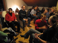
Farewell party crowds
more of them
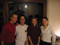
Wiland, me, Heike, Susi
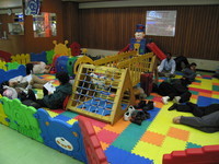
"Napping is strictly forbidden in this playground" (at Bangkok airport).
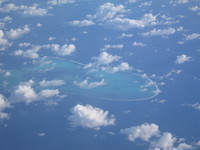
Approx. 600km east-south-east of Brisbane.
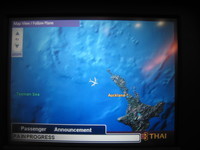
Pilot checking our pain progress. No wait, a passenger announcement (PA) is in progress!
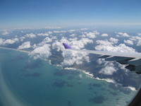
NZ shore, finally! Hooray!
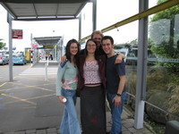
Liz, Ange and Raph picking me up at the airport.
Rose, me and Sarah playing super soaker twister
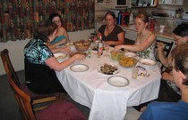
Potluck dinner!
Hanne and me hanging out in Christchurch. The random dude who took the photo cut off our legs! Damn!
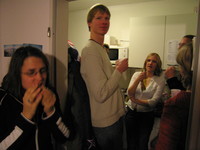
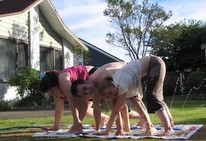
Patrick encounters the UCanDance concept of a party: Share the love.
Lake Tekapo, with the church of the good shepherd
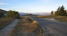
Lake Pukaki, near Twizel
View from the Kawarau bridge, where A.J. Hackett first commercialised bungy jumping in 1986 (I did a jump, too).
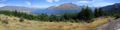
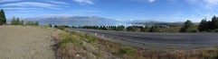
View over Queenstown and the Remarkables, from the summit of Queenstown hill
nearby
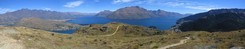
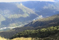
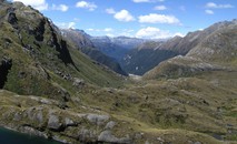
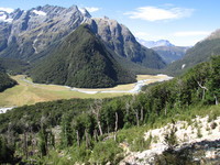
Lake Te Anau, viewn from just above where the Kepler track crosses the bushline on the first day's ascent.
Lake Te Anau, a little further to the left
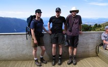
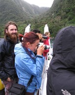
Us three hikers at Mt Luxmore Hut
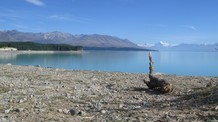
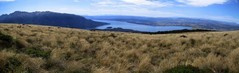
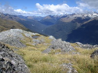
View onto Garnet Bay and Lake Te Anau from Mt Luxmore's summit (1472m)
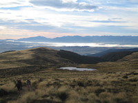
Early morning tramping, just beyond Luxmore Hut
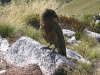
The Kea, New Zealand's native alpine parrot
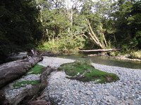
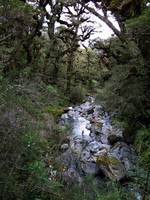
Iris Burn (?)
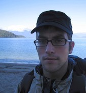
Me on the shores of Lake Manapouri, near Motorua Hut - check out my new glasses and cap!
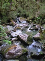
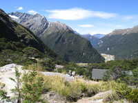
Near Rainbow Reach
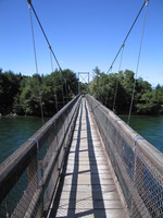
Swingbridge at Rainbow Reach, where most people finish the Kepler Track
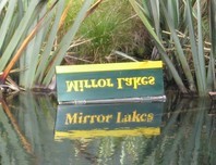
Mirror Lakes, on the way from Te Anau towards Milford Sound
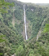
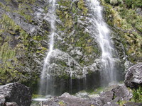
Humboldt Falls in the Hollyford Valley
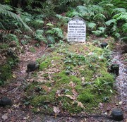
Scot Donald Keith's grave, who died from exhaustion in the Hollyford Valley. The grave is denoted "historic" and regarded an attraction, because it dates back as far as 1886 (wow!).
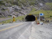
Homer tunnel near Milford, hardly wider than the average lane in New Zealand.
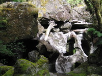
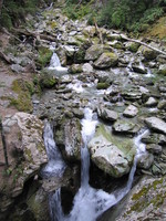
Some rocks on the Chasm Walk, 10km from Milford
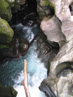
The Chasm
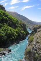
The Cleddau River, a mere 10m from where it has just plunged through the chasm.
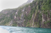
Steep fiord slopes formed by glaciers, at Milford Sound.
Look! Seals!

Look! Tourists! (surprisingly, the seals don't seem to care nearly as much)
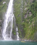
One of Milford Sound's numerous waterfalls, with some brave kayakers closing in.
The kayaks sure do look tiny against the waterfall; can you spot the yellow pixel?
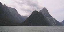
Mitre Peak, Milford Sound's icon, climbing steeply from the ocean floor right up to 1692m.
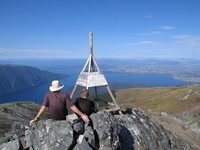
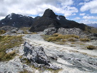
The key summit, 90 minutes into the Routeburn Track (we walked the track in the opposite direction).
Me at the key summit
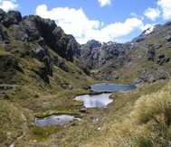
I presume this must be Lake Howden
Pass Creek (?)
closeup
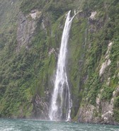
Earland Falls, at our climb's first peak.
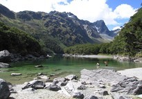
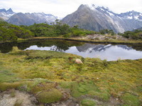
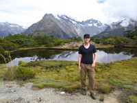
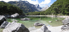
Beautiful Lake McKenzie
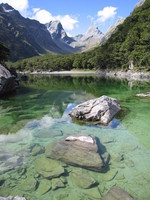
Lake McKenzie panorama
View onto Emily peak (1820m), towering above Lake McKenzie (950m)
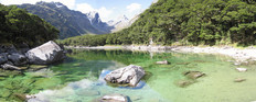
Another picture, just because the scenery is so pretty
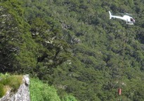
A helicopter, flying rich and lazy guided walk tourists' gear out from Lake McKenzie.
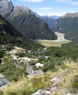
View into the Hollyford Valley from Conical Hill (1515m)
A little further to the left, still looking down into the Hollyford Valley
opposite direction
On our descent back to Harris Saddle (1277m)
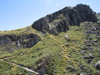
The side track leading from Harris Saddle up Conical Hill (and back)
View back onto Harris Saddle, with the emergency shelter in the center and Mts Gunn and Lyttle in the background
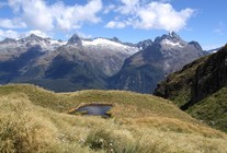
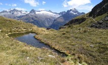
Lake Harris, just beneath Harris Saddle
View south (note the clearly visible bushline)
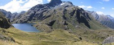
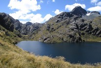
Lake Harris panorama
Routeburn Falls Hut, in an amazing location. I wish I had this view from my balcony!
A little closer
View just beyond the hut.
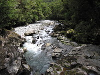
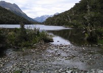
Route Burn, not far from the Routeburn Track's end.
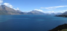
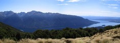
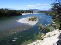
On our way back to Queenstown: Lake Wakatipu
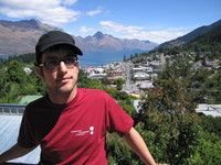
Me in Queenstown, by now having acquired more hair and still wearing my new cap and glasses.
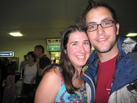
Back at Christchurch airport, I randomly ran into Erin. Wow, I look old!
| Last change: 2024-02-17 22:30:56 GMT+0100 |